What is the Meaning of a Physical Map – A physical map is a type of map that shows the natural physical features of an area or the Earth. It highlights landforms such as mountains, rivers, lakes, oceans, deserts, plains, and elevation changes using colors, shading, and symbols.
What Physical Maps Show
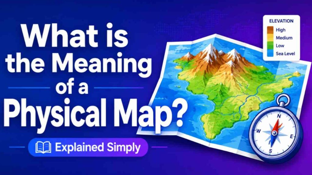
Physical maps focus on the Earth’s natural terrain and geography. They use color gradients to represent elevation:
- Green or light colors for lowlands and plains
- Brown or darker shades for mountains and highlands
- Blue for bodies of water
This helps viewers quickly understand the landscape’s shape, height, and natural characteristics.
How Physical Maps Work
Cartographers create physical maps by combining data from surveys, satellite imagery, and topographic measurements. They apply standardized colors and shading (hypsometric tints) to visualize relief and depth. Many include some political boundaries or cities for reference, but the main emphasis remains on natural features.
Physical Map vs. Political Map
These two are commonly confused:
- Physical Map: Shows natural landforms, terrain, and water bodies.
- Political Map: Shows human-made boundaries like countries, states, cities, and capitals.
Physical maps answer “What does the land look like?” while political maps answer “Who controls what area?”
Also Read-What is 1 Store App
Uses and Benefits
Physical maps help with:
- Understanding geography and terrain for travel or hiking.
- Studying Earth science, climate, and ecosystems in education.
- Planning infrastructure, agriculture, or environmental projects.
- Visualizing how natural features influence human settlement and history.
Examples
- A world physical map showing the Himalayas, Amazon River, and Sahara Desert.
- A regional map of the United States highlighting the Rocky Mountains and Great Plains.
- Relief maps used in classrooms to teach continental features.
FAQs : What is the Meaning of a Physical Map
What is the main purpose of a physical map?
o display the natural physical characteristics and elevation of the land, helping people understand the actual terrain of an area.
What colors are used on physical maps?
Greens for low elevations, browns and grays for higher mountains, and blues for water. Shades vary by height.
Do physical maps show cities or countries?
They may include some for reference, but the primary focus is on natural features, not political divisions.
What is a relief map?
A relief map is another name for a physical map that emphasizes the three-dimensional shape and elevation of the land.